![]()
 The recalculation of the amount of water which possibly could be drained from the reservoir during
an expected 180 m drop of the lake level due to former post jökulhlaup lake levels gave us an amount
of 3.3 - 3.7 km3. In addition to that a volume of 0.5 -0.7 km3 water kept in the ice fissure in the area
of the eruption has to be accounted. Therefore a volume of approx. 4 km3 had to be expected.
The recalculation of the amount of water which possibly could be drained from the reservoir during
an expected 180 m drop of the lake level due to former post jökulhlaup lake levels gave us an amount
of 3.3 - 3.7 km3. In addition to that a volume of 0.5 -0.7 km3 water kept in the ice fissure in the area
of the eruption has to be accounted. Therefore a volume of approx. 4 km3 had to be expected. At 9:30 pm of Nov. 4, the long expected jökulhlaup of Grímsvötn started. A continuous high frequency tremor was registered at a nearby seismic station on Grímsfjall caused by the lifting and breaking of the ice. At about 8:30 am on Nov. 5, water reached the glacier's rim and the rivers in Skeiðarársandur started to rise from a flowrate of 50 m3/s to 6000 m3/s at 10:00 am. Three hours later the water had flooded the sandur on its entire width of 35 km and length of 20 km and had already destroyed a 380 m long bridge across Gigjukvísl, furthermore had cut the main powerline along the coast and the optical telecommunication cable which had been burried deep in the sediments of the sandur plain.
At 3:00 pm the amount of water was estimated at 25,000 m3/s; at 10:30 pm the jökulhlaup
culminated. At that time an estimated amount of at least 45,000 m3/s flowed along a 50 km long
subglacial path beneath the outlet glacier Skeiðarárjökull down to the alluvial plane of
Skeiðarársandur, transporting ice blocks of more than 1000 tons which destroyed the bridges and
damaged the foundations severely.
The figure of a runoff volume of 45,000 m3/s at the peak of the jökulhlaup has to be understood as
an estimation. The accuracy of the measurements and additional estimations was affected by severe
changes in the drainage pattern of the glacial rivers and nighttime (sunrise 9:23 am, sunset 4:56 pm)
during the highest discharge rate.
All the day of Nov. 6, the water continued flowing to the sea on a continuously lowering level. In
the afternoon of Nov. 6, a cloud of steam rose to 5000 m altitude for about 20 min caused by a small
eruption in the eruption fissure which was possibly triggered by the lowering of water pressure.
On Nov. 7 around noon, the amount of water in the glacial streams diminished to a normal level and
the jökulhlaup had ended.
All the areas which were flooded remained covered by ice blocks of all sizes with a weight of up
to 2000 tons and a height of up to 10 - 15 m.
Two bridges and a 10 km long section of the ringroad were totally destroyed during the flood and
another three bridges and 10 km of the road were severely damaged. The periglacial runoff system
had been changed severely and millions of tons of sediments had been eroded and transported. For
example, the former 300 m wide riverbed, where the totally destroyed 380 m long Gigjukvísl bridge
was situated, has now widened to approx. 2 km.
 The ERS-2 subscene of Nov. 7 shows the area affected by the jökulhlaup. The flooded areas can
easily be recognized, mainly due to high reflectancy caused by the iceblocks which are spread all
over the flooded sandur plain. It can be observed that all the glacial rivers draining Skeiðarárjökull
were affected by the jökulhlaup and flooded most parts of Skeiðarársandur on their way to the sea,
before the water gathered behind the beach sand barrier to drain into the sea through some breaches.
The ERS-2 subscene of Nov. 7 shows the area affected by the jökulhlaup. The flooded areas can
easily be recognized, mainly due to high reflectancy caused by the iceblocks which are spread all
over the flooded sandur plain. It can be observed that all the glacial rivers draining Skeiðarárjökull
were affected by the jökulhlaup and flooded most parts of Skeiðarársandur on their way to the sea,
before the water gathered behind the beach sand barrier to drain into the sea through some breaches.
 The amount of meltwater flowing to the sea can also be distinguished in the NOAA-AVHRR data
by either the different reflection of the sediment loaden water (channel 2) and the lower temperature
of the meltwater (channel 4) which reaches the sea with a temperature close to 0°C and mixes very
slowely with the seawater with a temperature of approx. 10°C, due to the difference in density of
freshwater and seawater.
The amount of meltwater flowing to the sea can also be distinguished in the NOAA-AVHRR data
by either the different reflection of the sediment loaden water (channel 2) and the lower temperature
of the meltwater (channel 4) which reaches the sea with a temperature close to 0°C and mixes very
slowely with the seawater with a temperature of approx. 10°C, due to the difference in density of
freshwater and seawater.The jökulhlaup has transported more than 100 million tons of sediments directly to the sea.
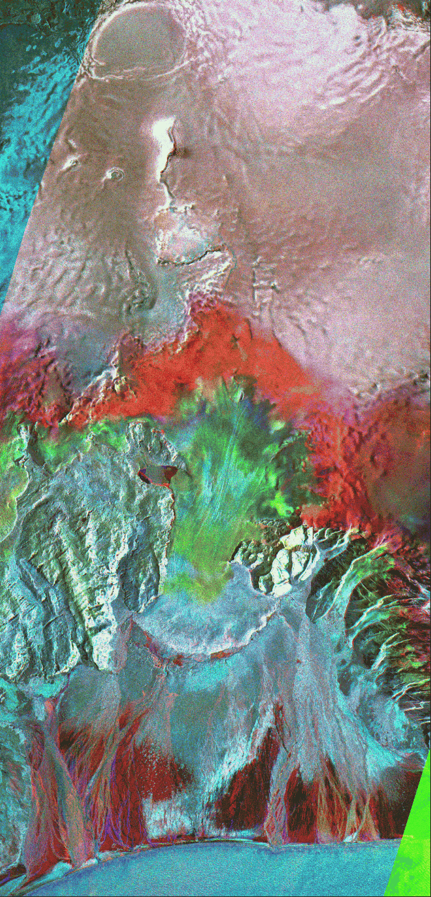 The multitemporal colour composite of ERS-1 and ERS-2 data shows the whole area which was
affected by the eruption and the following jökulhlaup. In the area of the erupting fissure the ice
movements caused by the lowering water level can be recognized.
The multitemporal colour composite of ERS-1 and ERS-2 data shows the whole area which was
affected by the eruption and the following jökulhlaup. In the area of the erupting fissure the ice
movements caused by the lowering water level can be recognized. A total amount of water which was drained to Skeiðarársandur alluvial plane was estimated close to 4 km3 (Oddur Sigurðsson, pers. comm. Nov. 8, 1996), that fits fairly good to our calculation of total expected runoff volume.
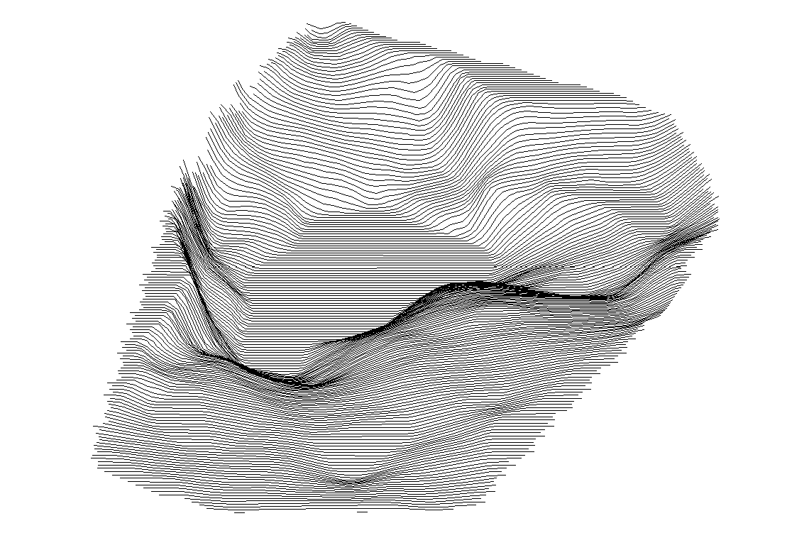
At the southeastern outlet of the Grímsvötn caldera clearly an approx. 6 km long, 500 m wide and up to 200 m deep ice canyon can be recognized. It is caused by the breaking of the roof of the subglacial channel which was created by the water forcing its way from the subglacial reservoir under the glacier over a distance of 50 km with a difference in altitude of about 1400 m down to Skeiðarársandur alluvial plain.
All together the amount of damage is estimated now at 31 Mio. US $ which means approx. 120 US $ for every Icelandic inhabitant. It will need at least two years to rebuild the ringroad completely.
At any time another subaerial or subglacial volcano may erupt in Iceland and endanger settlements
and livestock as well as infastructure.
Björnsson, H. (1988): Hydrology of Ice Caps in Volcanic Regions. Vísindafélag Íslendinga, Societas Scientarium Islandica, Rit. XLV, Reykjavík, 133 pp.
Björnsson, H. & Einarsson, P. (1990): Volcanoes beneath Vatnajökull: Evidence from Radio Echo-Sounding, Earthquakes and Jökulhlaups. - Jökull, 40: p. 147-168; Reykjavík.
Brandsdóttir, B., Björnsson, H., Guðmundsson, M. T., Einarsson, P., Pállson, F. (1996): Jökulhlaup Update. Internet document: http://www.rhi.is/~mmh/gos/vat-update.html.
In the case of the Vatnajökull eruption in South Iceland it could be approved that ERS-1/2 SAR data and SAR remote sensing techniques can be applied as an operational tool for the monitoring of volcanic eruptions and their adverse effects. Even in that tight schedule results of great value could be achieved. This was only possible in a remote sensing center with an existing infrastructure, a very fast processing chain from acquisition, raw data processing, geocoding, image processing and interpretation, plus a high amount of know how and manpower.
This presentation is part of the doctoral work of Bettina Müschen mueschen@dfd.dlr.de and Christoph Böhm boehm@dfd.dlr.de being undertaken at DFD.