|
|
But this image is special for another reason, since it also takes the fourth dimension,
time, into account. In order to create at DFD this cloudfree view of the earth, no fewer
than 60 individual scenes from the METEOSAT-5 weather satellite were collected over
a period of two months. One by one, one cloud-covered section after the other was
carefully replaced with a cloudfree image; in essence the time dimension was put to use
to make the spatial information complete. The structure of the ocean depths was made
visible by a digital elevation model constructed from conventional topographical maps.
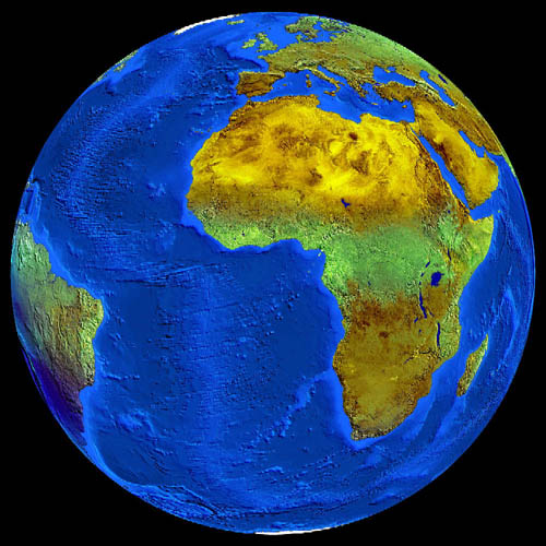
This example shows that remote sensing is more than simply collecting images from earth orbit; no satellite was ever confronted with a view like this! Intelligent processing of data on the ground is responsible for creating a useful image to meet a precise need, in this particular case to provide a background for moving clouds. Processing for another goal would have produced quite another image from the same raw data.
This image can be ordered from DFD through the Help Desk.
![]()