|
|
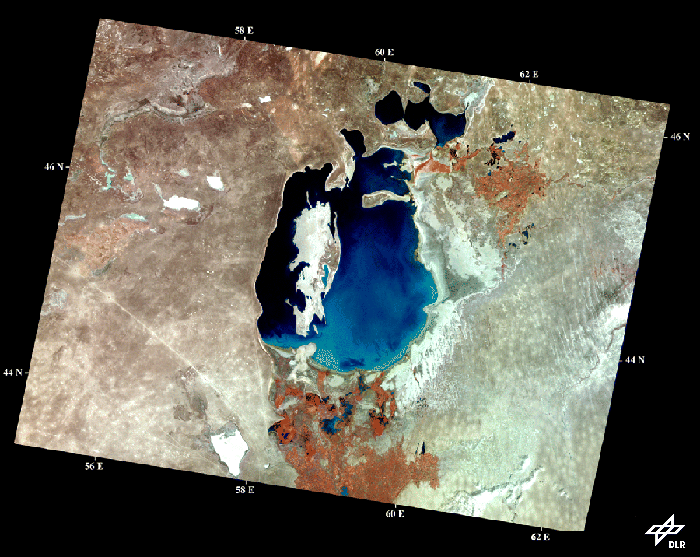
This image shows the Aral Sea and the Amu-Dar'ja delta (that's the red patch to the
south indicating agricultural activity) as it looked in 1996 when viewed from the vantage
point of space (by the MSU-SK instrument on RESURS-01, a Russian earth
observation satellite).
A series of images like this one collected between 1960 and the present reveal the
dramatic retreat of the shoreline and the growth of the islands visible in the lake as the
sea level declines. For example, the small lake in the north separated off from the Aral
Sea in 1987; the elongated E-W oriented island in the upper third of the remaining lake
became a peninsula in 1996 when its eastern edge joined the shore. Within about 4-5
years the small gap remaining to the south of the long N-S oriented island in the western
part of the lake is expected to close. Eventually the small gaps left at the western and
northern ends of these two islands will close, completing the process of separation of
the deep western basin from the shallow eastern portion of the Aral Sea.
Satellite remote sensing provides the technology to reliably monitor and document this
shrinkage process, and the data required by local decision makers who are
striving to establish sound water management and agricultural policies.
![]()