|
|
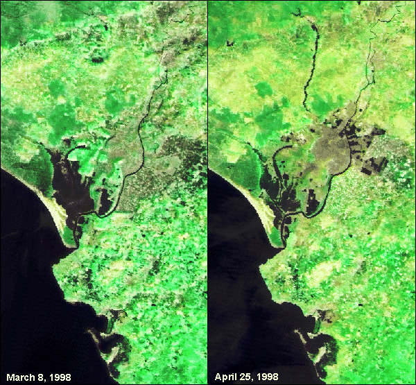
The salt marshes of the Doñana reserve, located near the middle of these images,
are fed by the Agrio River to the north. The river cannot be seen in the March image,
but by the time of the April image it had turned into a thick, dark band due to the load
of muddy slurry from the containment pond, visible as a small black square in
both images at top center. The river to the south of the reserve is the venerable
Guadalquivir, which flows through Seville in the northeast section of the image
(the city is barely visible in this particular image). Spanish efforts to dam the Agrio before
it entered the reserve were partially successful, but there is concern that the
groundwater may have been seriously contaminated and that the concentrations of
poisonous heavy metals in the soil may reach significant levels when the area
dries out in the heat of summer.
The image data was received and processed at DFD's Neustrelitz ground station and came from two sensors on the Indian IRS-P3 satellite: the Modular Optoelectronic Scanner (MOS), a spectrometer with a resolution of 500 meters, and the Wide Field Sensor (WiFS), with a resolution of 180 meters. The color composite was generated from three of MOS' 18 channels (B2, B8, and B10 were selected in order to optimize the contrast between vegetation and water). The hue and saturation values from MOS were then combined with the intensity (brightness) value from the higher resolution WIFS data.
For further information:
![]()