|
|
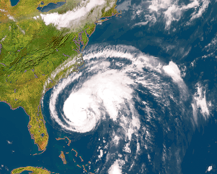
This image was processed at DFD on the basis of data from the thermal infrared channel of the GOES-8 Imager. It is a visualization of temperature data received from this U.S. weather satellite, superimposed over a cloudfree mosaic which had been previously generated from measurements of the AVHRR sensor on a NOAA satellite by Planetary Visions, London.
But this image not only illustrates how data gathered at two different times from two different sensors can be combined in one image to increase its information content; it is also the product of a smoothly functioning and rapid global telecommunication linkage.
The data were received at DFD's station in Oberpfaffenhofen, although its antenna is quite invisible to GOES-8, which is positioned in a stationary orbit over the USA. GOES sends its huge data stream to a NOAA receiving station at the Centre de Meteorologie Spatiale (CMS) in Lannion, France, at the northwest tip of France, where a selection of this data is compressed, reformatted, and sent to a European METEOSAT satellite, from where it can be directly received in Oberpfaffenhofen.
For more information
![]()