![]()
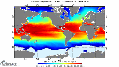
This section shows the global variation
of sea temperature over a 4-month time period. The maps are created
on a weekly basis and are made from altimetry data which are then
converted to show increase in temperature, salinity and speed. For
a more detailed explanation on the technique used, please go to
PSY2G:
moving towards global operational oceanography
(.pdf file).
Source: Mercator
zurück über den Browser