Einzelbeispiel satellitengestützter Erderkundung
Hochwasser in Oberitalien
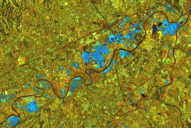
Northern Italy
The image represents the region of Alessandria, Piemonte. The Tanaro river flows from the left to the upper part of the image; near the top, just before the confluence with the Bormida river, lies the city of Alessandria, identifiable by yellow bright points. The other small pointed areas in yellow are other villages, while the two dark "stripes" crossing themself left to Alessandria are highways.
The colours in the image are achieved by merging an image of the 9th of November 1994 (assigned to the red chanel), one of the 4th of October 1994 (green), and an artificial channel (blue) which is the second principal component of the two scenes. This allows the visualization also small changes between the two acquisition dates.
The most significant changes are marked in cyan and show the flooded areas mainly located along the Tanaro river, representing a total surface within the image of 15,7 km2. A small lake on the upper left side of the city of Alessandria is imaged as a darker, blue patch, revealing that no changes occurred between the two dates. The other colours are only due to a much higher humidity on the 9 November respect to the 4 October: orange-red are bare soil, green are meadows and yellow settlements and orchyards (wineyards, etc.).
(Earth Watching Team/Eurimage, Rome)
Copyright ESA 1996
Quelle: ERS Spaceborne Radar Imagery, Copyright ESA 1996
![]()