Einzelbeispiel satellitengestützter Erderkundung
Mauretanien: Richat-Formation
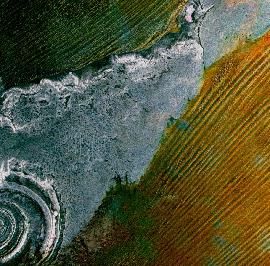
Richat structure
The ERS-1 SAR scene represents about 100 by 100 km and is composed of:
Red: 7 Dec 1992
Green: 15 Feb 1993
Blue: 13 Sep 1993
Centre of image: 21-21 North, 10-51 West
The multitemporal ERS-1 SAR scene is composed of one summer (13 Sept.) and two winter (7 Dec. and 15 Feb.) data acquisitions and reveals unexpected seasonal changes in this fully desertic area, which is indicated by the colours. In contrast to this the plateau is presented in white and grey, i.e. without any change. This old sedimentary rock, some 200m above the sandy desert includes the Richat ring structure made of a series of concentric quartzite ridges which is assumed to be the remains of an eroded magmatic intrusion.
The yellowish sand desert consists of large longitudinal dunes of some 300m, measured from crest to crest, but also of active (much smaller but well developed) dunes generated by winds rotated slightly towards north with respect to the large ones.
The yellow colour indicates a higher backscatter in winter which can only be explained by a somewhat slightly higher humidity content of the sand. As a concequence, less penetration of the microwaves into the sand can be expected. This could explain the blue spots indicating radar signal backscatter from sand-covered rock on the summer-date only.
(ERS Data Ulilization Section ESA/ESRIN)
Quelle: ERS Spaceborne Radar Imagery, Copyright ESA 1996
![]()