Einzelbeispiel satellitengestützter Erderkundung
Ship routeing in the Beaufort Sea
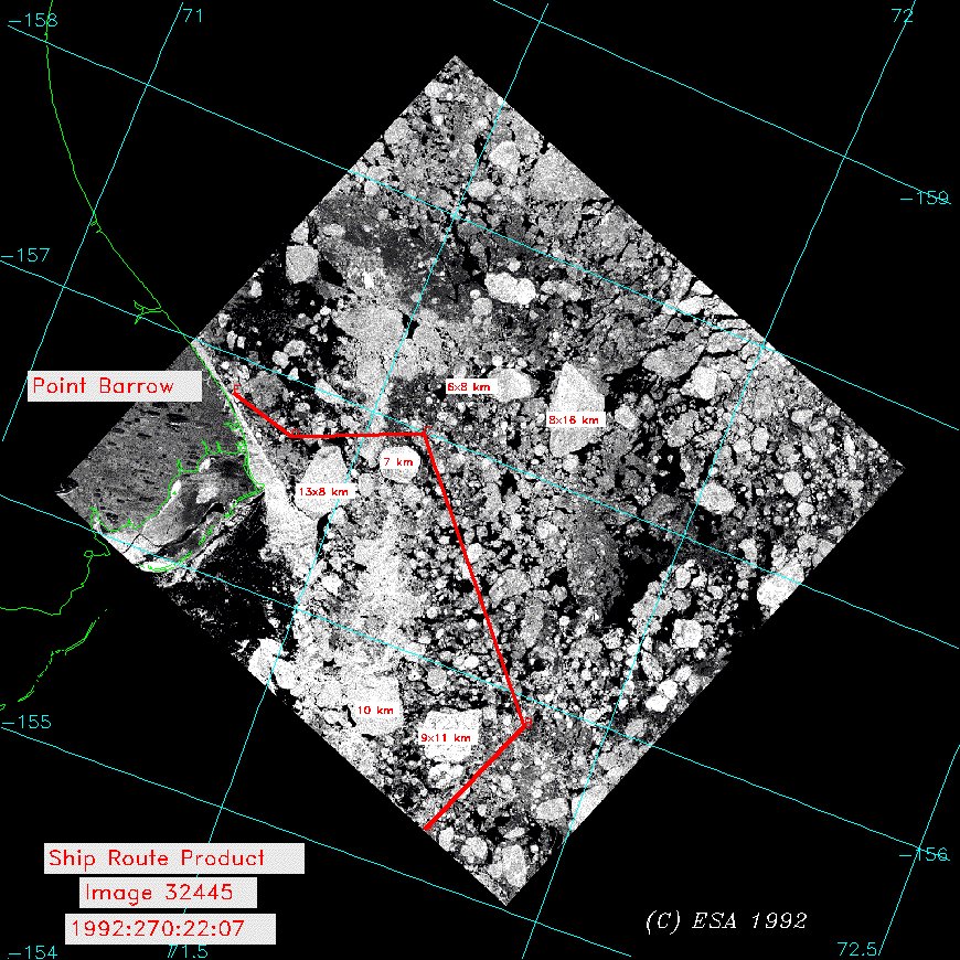
This image, which is from the 26th September 1992, was analyzed in support of the U.S. Coast Guard icebreaker Polar Star, which at the time was enroute to Point Barrow, Alaska after a ship rendezvous in the Canadian Archipelago. The analysis of the image allows the identification of several large multi-year ice floes which are considered hazards to navigation. The ship route software provides a course and heading for each designated waypoint on the recommended ship track .
The National Ice Center has had success in sending analyzed SAR imagery as well as other ice products to the USCG polar class icebreakers using Internet connections.
(Courtesy: C. Bertoia, National Ice Center, USA)
Quelle: ERS Spaceborne Radar Imagery, Copyright ESA 1996
![]()