Einzelbeispiel satellitengestützter Erderkundung
Wadi El Allaqui im Sudan
 |
 |
 |
| Landsat-Komposit 752 | ERS SAR | Kombination Landsat+SAR |
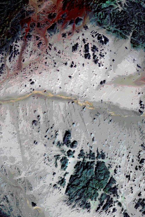
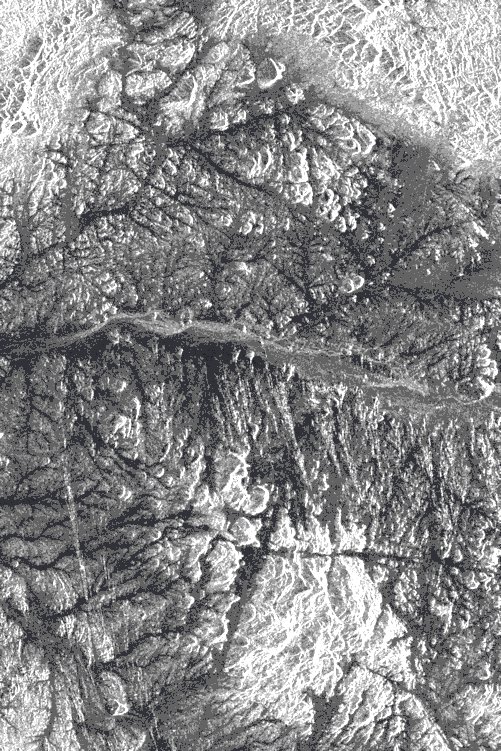
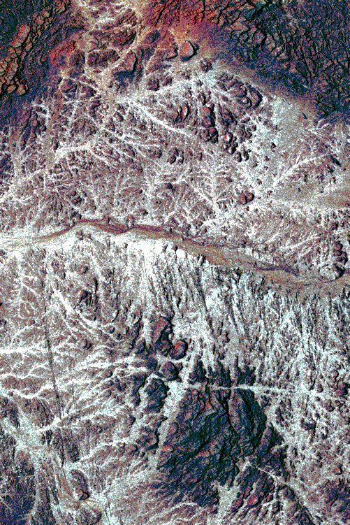
El'allaqui Wadi area (Egypt/Sudan border)
Landsat Thematic Mapper, data acquired on the 1/8/1989
The area is located between the Political and the Administrative boundary lines of Egypt and Sudan.
The main geological feature present in the images consists in a sandstone and graywacke basement from which has been extruded a granite magma (Dokan volcanics) from the East Africa Rift Valley opening.
The outcropping litologies are composed by metamorphic and sedimentary rocks represented, in the images, like small or big structures isolated essentially by water and wind erosional processes.
The optical Landsat TM data (752 band combination) allows to distinguish the main surface features like the wadi ElÕAllaqi (in brown-yellow) crossing the middle part of the picture and the different outcropping litologies (in dark tones) by different colours.
The ERS Synthetic Aperture Radar reveals a complex dendrithic drainage structure. It is the result of different surface roughness conditions and the microwave capability to penetrate the sand (if the soil is completely dry).
The optical - radar data merge (obtained by substitution of the Landsat intensity channel with the ERS image), permits to highlight both surface and underground information.
(Barbieri, Earth Watching Team/Eurimage, Rome)
Quelle: ERS Spaceborne Radar Imagery, Copyright ESA 1996
![]()